 NAVITONG
Navigation that worksacross borders.
NAVITONG is a free navigation app for Korea, Japan, Taiwan and more than 200 countries and territories across Asia, Europe, North America, South America, Africa and Oceania. It analyses 2.7 billion pieces of road data from around the world and connects them into one road network. It finds routes right after install and shows arrival times that reflect traffic. It is in Korean today; Japanese, Chinese and English are on the way.

What NAVITONG does
Your language, abroad
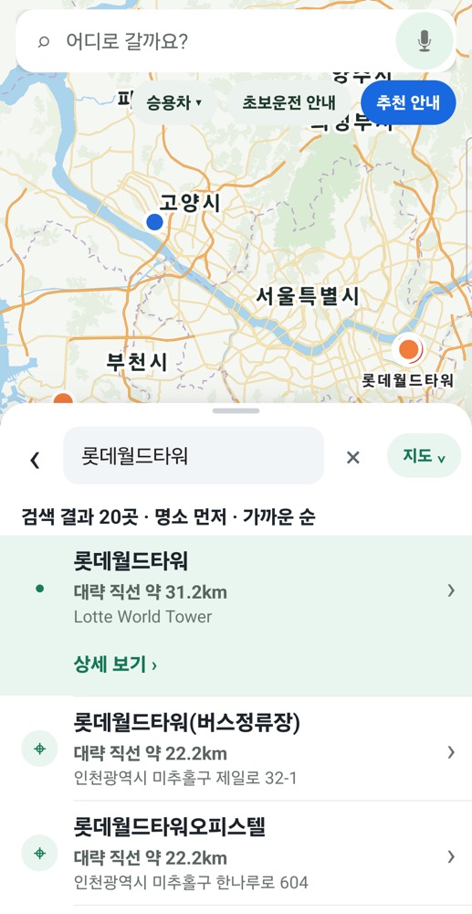
Search and voice guidance in Korean today, with Japanese, Chinese and English in preparation. Places abroad, from Tokyo Station to Machu Picchu and the Pyramids, are found even without a downloaded map.
Works right after install
No map download needed: routes, a detailed map and traffic-aware arrival times from the start.
Beginner-driver routes
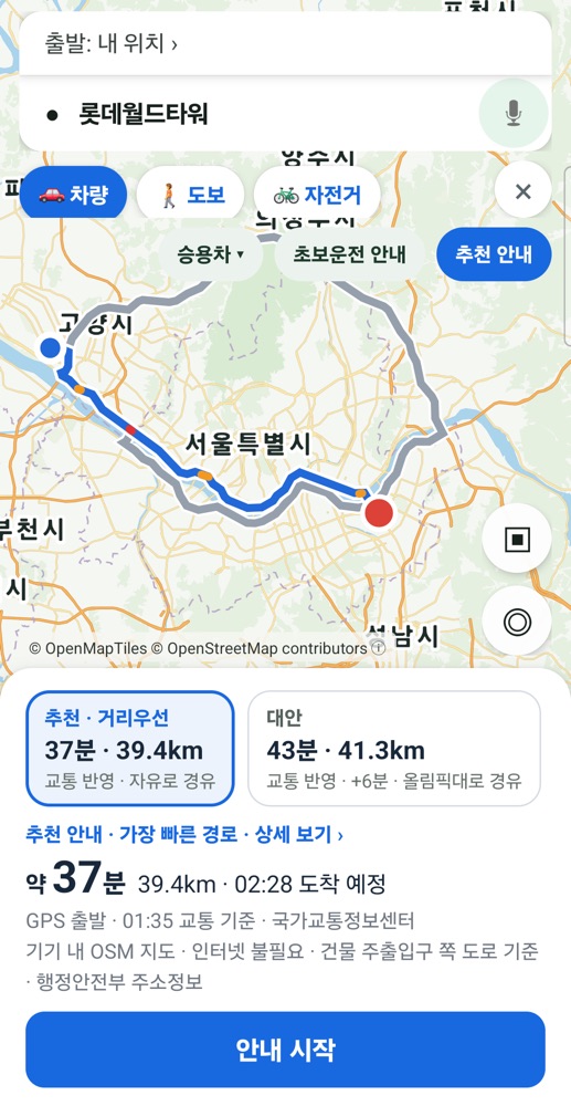
Routes with fewer U-turns and sharp turns come first, compared side by side with alternatives.
Highway mode
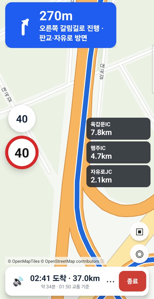
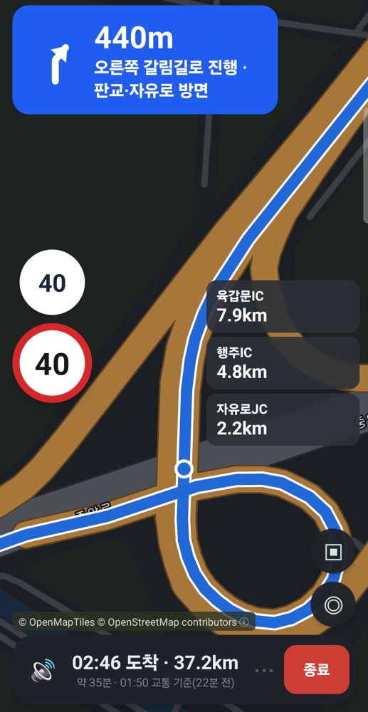
The next interchanges, junctions and rest areas with distances at a glance, plus a heads-up for the last rest area.
Safe-driving help
Speed limits and speed cameras, position estimates in tunnels, and a dark map at night and in tunnels.
Guidance that survives a lost connection
Turn on "Offline use" in Settings and download maps by country and region: when the connection drops, NAVITONG finds the way on those maps and keeps guiding, and it tells you before you leave them.
Drive, walk or cycle
Not only for driving: NAVITONG finds walking and cycling routes too, with voice guidance, and its maps include footpaths and cycle paths.
Public transit
In the Seoul metropolitan area NAVITONG also finds bus and subway routes with transfers: best, fastest, fewest transfers or least walking, with the next vehicle's arrival (with its time basis) and an estimated fare.
Simulated drive
Pick a start point and drive the route in advance with the real guidance screen and voice: check the way from the airport to your hotel before you travel.
Arrive at the right door
In Korea NAVITONG guides you to a building's vehicle or pedestrian entrance. You can move the arrival point on the map, or tell us about a different entrance in the app.
Maps for more of the world
After Asia, South America, Africa, Europe and North America, Australia, New Zealand and the South Pacific islands are mapped too: more than 200 countries and territories. The maps keep being refreshed from new road data.
Navigation that keeps your privacy
No sign-up. Your position is rounded to about 100 m when you search and is never stored; with maps downloaded, even your start and destination stay on the phone.
Coverage
Starting with Korea, NAVITONG now covers more than 200 countries and territories across Asia-Pacific, Europe, the Americas and Oceania.
Screens
FAQ
Is it really free?
Yes. NAVITONG is free, with no ads on the guidance screens and no sign-up.
Does it work without a data connection?
Turn on "Offline use" in Settings and download a region: driving, walking and cycling routes and guidance there then work offline. If the connection drops while guiding, NAVITONG switches to those maps by itself and fetches traffic again once you are back online. Regions are tens to a few hundred MB each, so use Wi-Fi.
Can I use it on foot or by bike?
Yes. Choose car, walking or cycling on the route screen to get a matching route and voice guidance, also with downloaded offline maps, on Android and iPhone.
Does it do public transit?
Yes, in the Seoul metropolitan area (Seoul, Gyeonggi, Incheon) and in Busan, Ulsan, Daegu, Gwangju, Daejeon, Sejong and Jeju: choose 'transit' on the route screen; an internet connection is needed. Bus times are estimates based on headways, and next-vehicle arrivals are shown with their time basis. More regions and cities abroad will follow.
Which countries does it cover?
Korea, Japan, Taiwan, Southeast Asia, Guam and Saipan, Hong Kong, Macau and Mongolia, South Asia, the Middle East, Central Asia and the Caucasus, the Russian Far East and Siberia, South America, Africa and Europe, including Turkey, Georgia and western Russia, plus the US, Canada, Mexico, Central America and the Caribbean, and Australia, New Zealand and the South Pacific islands: more than 200 countries and territories. China, North Korea, Cuba, Iran and Syria are not covered.
Is the traffic information real time?
Arrival times use data from Korea's National Transport Information Center. It is not real time, so the data time is always shown.
What language is the app in?
Today the app and its voice guidance are in Korean. Japanese, Traditional Chinese and English versions are in preparation.
How do I contact you?
Email or call us using the details below. admin@kcrew.co.kr · +82-31-8076-1111